
DroidEFB - Fly with Android
 (Android app)
DroidEFB, LLC
383 1K


Screenshots


Description
US Only, VFR and IFR
DATA PURCHASE REQUIRED after 30 day free trial
$6.99/mo, $74.99/yr (Standard) or $149.99/yr (Premium)
For pilots using Phones and Tablets running Android 4.0 or higher
One subscription or free trial may be used on multiple devices such as a phone and tablet. Subscriptions authenticated using the Google account on your Android device. 30 day free trial features a Standard subscription with no restrictions.
Highly capable and responsive, this Electronic Flight Bag (EFB) reduces cockpit workload and provides relevant information when you need it. DroidEFB™ matches many features found in the ForeFlight® app, which only runs on Apple’s more expensive mobile devices.
DroidEFB overlays current position and flight plan onto an FAA Sectional, TAC, Low Altitude or High Altitude chart. On the ground, current weather information is overlaid for long range planning; helping pilots visualize the impact current conditions will have on their flight.
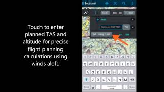
Input and easily amend airports, waypoints, victor/jet airways, GPS coordinates and DME. Advanced navigation log with time/distance/bearing info takes into account current winds aloft using proprietary algorithms.
Once airborne, routes flown can be stored as GPS breadcrumbs, uploaded and viewed in Google Earth. https://droidefb.com/tutorials/
All charts and plates are viewable via our servers with an Internet connection and are downloadable for offline use. RouteMinder™ automatically checks the planned route for Charts needing downloaded.
DroidEFB can also be used to receive and file official briefings through Lockheed Martin Flight Services (LMFS) AFSS! Register at www.1800wxbrief.com/Website/ and enable Avilution/DroidEFB in the list of service providers (Flight Planning & Briefing > Service Provider) to receive notifications.
DroidEFB Features:
-Point of Interest (POI) Search - find and save airports, street addresses, business names, coordinates
-Approach plates and airport diagrams (Geo-referenced with Premium subscription)
-Create, save and sync user waypoints and Flight Plans
-NEXRAD and ADS-B traffic (TIS-B) w/supported devices
-Write or draw on charts and terminal procedures
-Sophisticated weight and balance
-FBO Fuel Price (100LL; Jet A)
-VSR (vertical speed required)
-Store data on External SD
-A/FD (chart supplement)
-Pinch zoom and measure
-Redundant data servers
-Real-time GPS tracking
-Grand Canyon Charts
-Helicopter Charts
-Track prediction
-Auto Logbook
-SAR patterns
-Track Log
-SUA
Weather Overlay:
-NEXRAD (Internet, MobileLink, ADS-B)
-SIGMET / AIRMET (Internet, MobileLink)
-METAR (Internet, MobileLink, ADS-B)
-PIREP (Internet, MobileLink, ADS-B)
-TAF (Internet, MobileLink, ADS-B)
-Surface and winds aloft (Internet)
-Current Icing Potential (Internet)
-Satellite imagery (MobileLink)
-Lightning strikes (MobileLink)
-Freezing levels (MobileLink)
-NOTAMs (Internet, ADS-B)
-Area forecast (Internet)
-TFRs (Internet)
Third party devices and programs integration:
-Baron MobileLink
-iLevil with AHRS
-Microsoft FSX
-Dual XGPS
-ZAON XRX
-Pathfinder
-SkyRadar
-X-Plane
-Stratux
FAA Approved - Class 1 Electronic Flight Bag (EFB)
Reference AC91-78 and AIM Chapter 1 for regarding removal of paper aeronautical charts from the cockpit and use of handheld devices for navigation
We cannot respond to feedback, app issues or feature requests left in Google Play reviews. For application support or to leave feedback, please visit https://www.droidefb.com
Rooted devices not "officially" supported
